
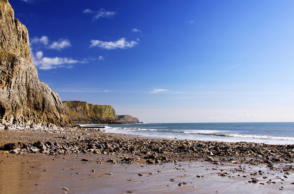
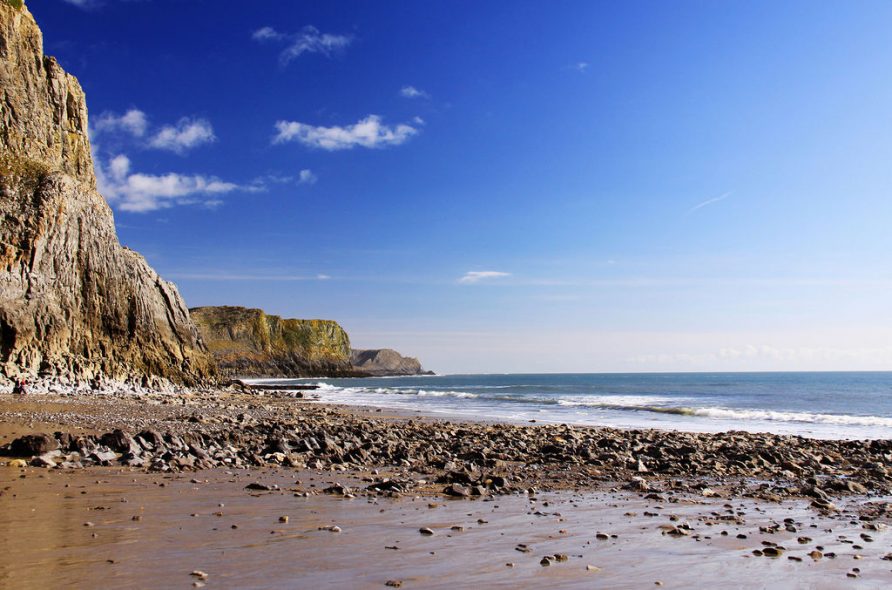
Rhossili & Worms Head Walk
An unforgettable walk, but one which needs careful planning – you can only cross the causeway to Worms Head for 2.5 hours either side of low tide. Never be tempted to swim the causeway if you get cut off, many people have lost their lives in this water. Follow this link to find the current tide times in the area.
Distance covered: 3 miles
Average time: 2 hours
Terrain: Generally easy but good climbs down to the beach and back.
Directions:
From the top of our track, turn left for 1.6 miles as you approach Burry Green, turn right for 0.3 miles follow this lane until a triangle junction and turn right onto the south Gower road (A4118) to the village of Scurlage and turn right onto the B4247 for Rhossili. Follow the road through the village and park in the large car park next to the Worms Head hotel . You can’t miss it.
Walk to the seaward side of the car park and pass through one of the gaps in the wall onto the lane on the other side. Turn left and follow the lane out through the gates towards Worms Head.
The view of Rhossili bay over the three miles to Burry Holms at the Llangennith end of the beach is breathtaking. If you have sharp eyes you should just make out the wreck of the Helvetia, an oak barque wrecked here on the 1st November 1887 and now reduced to a series of heavy wooden spars stretching from the sand a little way down the beach. The Helvetia was sheltering in the bay during a gale but as nightfall approached she dragged anchor and had to be abandoned. By morning the ship was wrecked and her cargo of 500 tons of timber was strewn along the beach.
Follow the path until you reach the old coast guard lookout above the Worms Head causeway.
The name ‘Worms Head’ is a corruption of the Old Norse word for Dragon – apparently what this headland looked like to the invading Norsemen as they arrived at Gower from the sea.
When you arrive at the coast guard station at the end of the headland you will see the path in front of you dropping down to the causeway, but before you descend, it is a good time to check that you have your tide times correct. Tide times are usually displayed at the coast guard station – if you have any doubts and the coastguard station is manned pop over ask. Remember that the causeway is exposed and safe to cross for a maximum of 2.5 hours either side of low tide
Now that you are confident about the tide times, follow the path down the headland and cross the causeway. It takes about 15 minutes to cross the jagged and slippery rocks.
Follow the path up onto Worms Head and to the left (south) out along the flat top of the inner headland – you will then descend. Bear to the left, crossing a natural rock bridge known as the Devils bridge, and cross the lower neck to outer headland (again bearing to the left.) Please note that you cannot climb to the top of the outer headland between the 1st March and the 31st of August – it is closed in order to protect the many breeding sea birds.
On the north side of the outer head you may see the blowhole working – if a big swell is running, the water sometimes jets many feet up into the air.
Remember to keep an eye on the time while you are out on the worm to avoid getting stranded there.
When you get back to the village, the local church (St Mary’s) set next to the car park is worth a visit.
St Mary’s dates back to 12th Century, replacing an earlier church which is thought to have been in existence from the 6th century that was set at the bottom of Rhossili Downs. It reportedly fell foul to the ravages of powerful storms during the 13th century and resulted in the new church and village being constructed at its present location away from the encroaching sea and sand. The church is entered through a beautifully ornate carved archway very typically Norman. On the left hand pillar there is a rare scratch sun dial. There is good evidence to suggest that the archway was scavenged from the original church. In the chancel you will find an original 14th Century window, known as the “leper’s window” – it is set low so as to allow the feared lepers to hear the word of the scriptures from outside! Also have a look at the memorials in the nave – they include one to Petty Officer Edgar Evans, a Rhossili man who died with Captain Scott in the Antarctic in 1912.
Interesting further evidence of the presence of the Normans in Rhossili is the rare 12 century open field system known as ‘the Vile’ which stretches from the church all the way out to the headland next to Worms Head.
Circular Walks
Mewslade Bay & Fall Bay Walk
Explore two of Gower’s most beautiful and rugged bays – a thoroughly recommended way to lose an afternoon.
Distance covered: 1 miles
Average time: 1.5 hours
Terrain: Expect steep narrow cliff paths and some mud in winter.
Directions:
From the top of our track, turn left for 1.6 miles as you approach Burry Green, turn right for 0.3 miles follow this lane until a triangle junction and turn right onto the south Gower road (A4118) to the village of Scurlage and turn right onto the B4247 for Rhossili. When you drop down into the village of Pitton take the only left hand turn in the village. The road will bear round to the left (downhill). Turn left into the first gateway to the car parking field. There is an honesty box on the gate post for your parking fee.
Walk out of the car park and turn left, then bear immediately right around the old barns and garages. Just in front of you, you will see a gate just on the right of the green tin barn – Passing though it will take you out along a narrow wooded track, past two small chalets in the field on the left, and down towards the beach. Pass through the gate out of the woods and continue downhill towards the beach.
The beach is a favourite with local surfers, but if you fancy a swim it’s not advisable if the surf is big because there will be a strong accompanying undertow.
Before you meet the rocks at the head of the beach, you need to take the cliff path to the right. The path will take you up over the headlands, all the way to Fall Bay. When you come over the last headland above Fall Bay, look for a wooden set of steps taking you up on to the farmland on your right. Once up in the fields, take the stile 30 yards ahead on the right, then bear left along the field boundaries until you find yourself following a farm track. The track will emerge at the main road in the village of Middleton . From here, turn right down the main road for 700m, continue past the old chapel until you see the turning in Pilton back to the car park.
Tankey Lake & Llanmadoc Walk
Spectacular views over Llangennith, Whitford Point, and the north Gower salt marshes. Lunchtime stop at the Britannia for some great food and ales!
Distance covered: 4.5 miles
Average time: 1.5 hours
Terrain: Some moderate climbs.
Directions:
Once out of the Tankey Lake Livery car park look up the hill closest to us and choose the path that keep you skirting the hill – once on the north side (overlooking Whiteford Point) the path will climb steadily until you once again meet the edge of the farmland.
Keep your eyes peeled and eventually the you will see the entrance of a rough track which descends through the farmland into the village of Llanmadoc.
On your left as you enter the village you will see Llanmadoc church. The building’s origins can be traced back to the 13th century, though much of what meets the eye today dates to a very extensive renovation of the church in 1865. The reverend J. D. Davies was rector of Llanmadoc and Cheriton from 1860 to 1911 and famously wrote a book, “A History of west Gower” referred to by many as “the Gower Bible.” The extensive work documents much of the history, customs and folklore of the area, and may be found for viewing in the reference library in Swansea. The Reverend was also a skilled carpenter – he personally carved the oak alter found within the church and also built the beautiful Swiss styled rectory across the road, inspired by a holiday to Switzerland.
Once you meet the tarmac lane which runs through the village, turn right and walk down towards the Britannia pub. If you haven’t brought a packed lunch, this is a perfect place to stop and eat a relaxing lunch. As you are walking down to the pub, keep looking on your right for a footpath sign directing you up another small lane and back on to Llanmadoc hill.
After your well-earned rest, set off back up the lane to the common land beyond. Take the path which bears left up onto the top of the rise and then follow the path right along the ridge of the hill. The path you take passes through the remains of a late prehistoric hill fort known as the Bulwark, before climbing to the summit of Llanmadoc hill, which at 610ft in one of the highest points on the peninsula, with spectacular views in all directions. Now follow the path which gently drops down the southern side of the hill and back to the cottage.
Pwll Du, Ilston and Three Cliffs Walk
A long circular walk beginning at the village of Southgate, following coastline to Pwll Du, then circling inland up Bishopston valley to the picturesque village of Ilston before returning to the coast via Three Cliffs valley. You will need OS map Gower 164 to complete this walk as the map below will not have adequate detail to allow you to easily find the footpaths between Kittle and Ilston.
Distance covered: 8.5 miles
Average time: 5 hours
Terrain: Varied – Expect some steep paths and lots of mud in the winter.
Directions:
From the top of our track, turn left for 1.6 miles as you approach Burry Green, turn right for 0.3 miles, take a slight left past the water works, keeping going past the post office. At the T-junction turn left and then immediate right. Keep following the road through Reynoldston until a t junction, turn left onto the A4118 for 5.2 miles. Turn right onto Vennaway Lane (B4436) for 0.6 miles. At the T-junction turn right onto Pennard Road and keep following bear round to the left by the golf course onto Southgate road for 0.5 miles. Park in the National Trust car park (SS 55310 87461) next to Three Cliffs Coffee Shop.
From the car park, face the coast and turn left following the cliff top path. As you walk in the direction of Hunts bay, about 600m from where you have parked, you can find Minchin Hole bone caves. Be careful if you decide to go down to the cave – it is a really dangerous scramble! (Also probably the reason that the cave is in such pristine condition today.)
The cave has been excavated on a number of occasions in the past; the first of which took place in the mid nineteenth century. The many recovered artefacts now lie in Swansea Museum, including the remains of a straight-tusked elephant, bison, soft-nosed rhinoceros, cave bear, reindeer, wolf and hyena.
Along with the animal remains which indicate residence in the upper Palaeolithic period, evidence of later occupation in the form of pottery (pots, dishes, boles, spindle whorls, combs, bronze brooches and a number of coins) indicate that the cave was still in use during the Romano-British occupation and later on in the Dark Ages.
A little further along the coast on the western headland of Deep Slade there is a second cave known as Bacon Hole (reportedly on account of one of the formations within the cave which bears some resemblance to streaky bacon!) The cave was first excavated in 1850 by Colonel Wood who documented the presence of various Pleistocene animals including the straight-nosed elephant and narrow-nosed rhinoceros. Later excavations also uncovered early Iron-Age pottery. The cave is also believed to have been occupied by humans during the Roman occupation, the Dark Ages and throughout Medieval times.
Also well worth looking out for while you are exploring these cliffs is a quite insignificant looking but very rare plant known as Yellow whitlowgrass (Draba aizoides.) It only grows about 2 inches high and carries yellow flowers in late winter to mid spring. A member of the Brassicaceae family the plant is widely distributed in continental Europe. This is the only place in the UK where it can be found.
Now continue along the coastal path, past the large rocky cove of Hunts Bay, and up onto the headland. As you round the headland you will discover breath-taking views of the picturesque Pwll Du Bay. The path will take you down to the small group of remote cottages at the head of the beach. I’m sure at this point you will want to take a detour down onto the sands before returning here to pick up the path again.
Much of the scenery of this beautiful bay results from the quarrying activities which existed here until the beginning of the 20th century. Rights of “cliffage” were awarded to farming tenants, who could then quarry the limestone from the slopes of Pwll Du Head which was then shipped across the water to Devon where it was cooked to make agricultural lime.
Looking to the east of the bay you can still clearly see where the limestone was removed from the cliff. The stone was then piled a short way from low water and marked with a post. Ships then sailed into the cove at high tide, located the posts and remained there until the tide dropped, leaving the ship beached and ready to be loaded before the next high tide. I have also read that some of the ships would actually scuttle their vessels before the tide had fully dropped and as the ship beached the sea cocks would again be closed, the water partially filling the hold of the ship would break the fall of the cargo of rock as it was loaded. The remaining water would be drained out before the tide returned. It is also speculated that much of the limestone making up the huge shingle banks at the head of the beach are also derived from the smaller pieces of stone left on the beach after the ships were hurriedly loaded between the tides. The houses nestling at the head of the beach were once pubs serving the thirsty workers.
When you have finished exploring the beach, pick up the path again at the rear of the cottages. You need to take the path directly north up Bishopston valley – make sure that you always follow the river on its west side, staying for all but the very last part of the journey near to the valley floor. You are heading for Kittle village, so don’t be tempted to take any of the paths east for Bishopston.
At the head of the valley you will join a lane – at the first opportunity bear right. The lane will take you up to a junction with the main road. Turn left down the main road and after 50m turn right into the gravel car park of Barlands Common.
Follow the lane which heads downhill to the west. When the lane bears ninety degrees right take the footpath which leads straight on into a small woodland – It is well waymarked. Follow it for half a mile until you emerge next to Kittle Hill farm. Turn right along the lane and continue until you meet the main road.
Cross the main road and continue down the lane and across the ford. When you get to Court House Farm, take the track to the right before the farm entrance and follow the path across the fields and down into the village of Ilston. When you meet the lane at Ilston village, turn right and then left. Make your way into the churchyard.
History of Ilston Church:
The Church at Ilston which you see today and is dedicated to St Illtyd but is just a token of the ecclesiastical history associated with this village and valley. In the 1640s, fuelled by the newfound religious freedom of the civil war years and the breakdown in censorship, the Baptist movement flourished. A little further down the valley you will come across the ruins of the first Baptist church established in Wales. The church was established by John Miles on the 1st October 1649. A great deal of fascinating history in known about the area due to the survival of the ‘Ilston Churchbook’, now preserved in America. The book is an interesting commentary of the times, some funny titbits are for instance, how Miles apparently was rather disappointed that his first two converts at Ilston were women, though consoled himself by believing that the Lord was ‘thereby teaching us not to despise the day of small things’! Another entry during the 1650s describes how a handful of members were expelled from the church for drunkenness and sexual misconduct!
During the 1650s Miles was very successful at spreading the word throughout south Wales and influencing the foundation of further churches as far a field as Hay on Wye, Llantrisant, Carmarthen and Abergavenny. Ultimately, due to the Restoration, Miles’s fortunes waned. He was ejected as minister of Ilston parish and ultimately emigrated to Rehoboth, Massachusetts, where founded the first Baptist church in that state. Unfortunately he was expelled from Rehoboth in 1667, after which he moved on and founded a new town, which he named Swansea.
At the far end of the church you will find a gate, through which you can pass, taking you into Ilston valley. Don’t take any of the paths which bear off to the left or right, just stay on the valley floor, roughly following the path of the river. The geology of this area is predominantly limestone and in true form the river in this valley often finds its way below ground into the many cracks and cave systems which have been worn by the water over thousands of years. In the winter the river flows the length of the valley to Parkmill while in the summer the river often disappears leaving just a dry river bed shortly after the church.
At the Parkmill end of the valley you will emerge into the Gower Inn pub car park. I’m sure you will have worked up enough of a thirst to be tempted in to try an ale and maybe some lunch?
That done, turn right onto the main road. After about 100m you will see a turning on the left. Cross the bridge, the road turns first left, then as it bears back to the right (only 20m from the turning) you can take the footpath which takes you into the woods and follows the lower edge of the valley. Continue past the blue footbridge and after about 200m take the path to the left. It will take you up past some old wooden cottages and emerge on Pennard golf course.
Follow the path along the edge of the golf course taking in the beautiful views down Three Cliffs valley towards the bay and Pennard castle.
Pennard Castle, originally a possession of Henry de Beaumont, was established in the 12th century probably as a ringwork castle. The stone castle we see today was likely constructed in the late 13th or early 14th century and the work of the De Breos family. The castle and surrounding village were abandoned by 1400 though the church (St. Marys) continued in use until 1532 when it finally succumbed to the encroaching sand – the sand blew in from the beaches and choked the agricultural land. Records note that tithes (taxes) were lowered to help the struggling farmers survive.
With regard to the be-sanding, though a geographer may have an alternative explanation, the truth is that many hundreds of years ago there was warlike chieftain called Prince Rhys ap Iestyn who once lived in the castle. He had won the hand of a prince’s daughter as reward for his battle exploits. A great feast was prepared to celebrate the forthcoming marriage. However the celebrations were disturbed by strange noises coming from magical lights dancing at a grassy area on the other side of the valley. Rhys ordered some of his men to discover the cause of the commotion. The men returned and said “Sire, ’tis the Tylwyth Teg (the fairies of welsh folklore) feasting and dancing. Rhys was so annoyed that the Tylwyth Teg would interfering with his celebrations that he summoned his men to attack them. Everybody begged him not to interfere as they knew the Tylwyth Teg wore not to be medlled with, but Rhys – too drunk to think rationally – bragged, “I have nothing to fear from the little people!” The chieftain and his men ran down to the grassy area and attacked the Tylwyth Teg, who (as everyone knows!) can only be seen but not touched. Nonetheless they were not very pleased that the chieftain had spoiled their innocent fun and so cursed the chieftain, sending a storm of unimaginable proportions to bury the castle under the deep sands.
Continue along the top of the valley and around the headland above the Three Cliffs.
It is well worth a short detour here to walk out along the neck of three cliffs, especially if the tide is in. The next bay you will pass as you continue along the coast is Pobbles. A good safe beach if you fancy a swim. Then climb back up to the coastal path and follow the cliff edge past Foxhole Bay. You should now recognise the National Trust car park on the cliff top where you left your car.